
Senior engineer building at the intersection of satellite remote sensing, geospatial data engineering, and cloud-native platforms. From raw orbital data to production web applications.
My career traces the complete path from satellite sensor physics to production web platforms — calibrating raw orbital data, architecting near-real-time processing pipelines, designing cloud infrastructure, and building the frontends where users interact with geospatial intelligence.
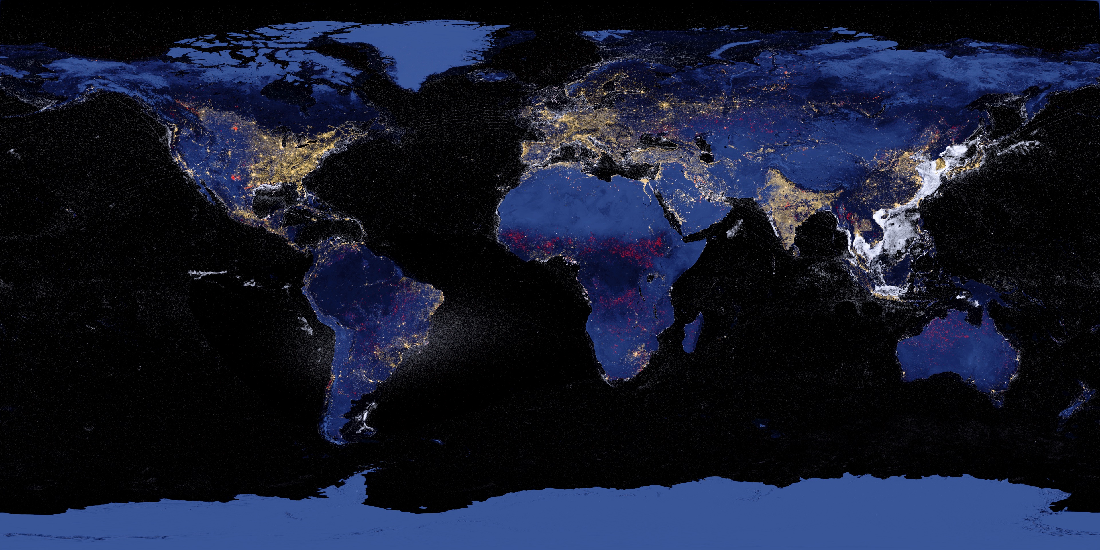
At CIRES (University of Colorado Boulder) and Colorado School of Mines, I spent eight years building production pipelines for VIIRS and DMSP satellite imagery, developing radiometric calibration algorithms, worked on Nightfire gas flare detection effort that supported the World Bank's global carbon tracking, and monitoring fishing vessel for IUU activities.
At National Laboratory of the Rockies, I scaled that foundation — architecting AWS cloud platforms, building web applications with serverless architecture, and managed data repositories for cross-displine research teams.
Interactive global nighttime lights explorer built from VIIRS DNB and Nightfire data. Composite visualization combining nighttime radiance, boat detections, and gas flare monitoring into a single map product — the same imagery used as this site's background.
Full InSAR coherence time series pipeline from 127 Sentinel-1 CSLC acquisitions. Interferometric coherence analysis with invariant target normalization, Wiener filtering, polynomial curvature validation, and automated recovery detection.
Five AI agents with distinct reasoning styles, per-agent model selection, web search integration, context window compression, and human input injection for structured debate and analysis.
Target-centric satellite observation prediction tool. Uses SGP4 orbital propagation with bearing-convergence algorithm to determine when a sensor footprint crosses a ground target — with 3D CesiumJS globe, swath visualization, and pushbroom/off-nadir sensor models.
Serverless REST API for satellite orbital data — TLE retrieval, SGP4 propagation, and pass predictions backed by AWS API Gateway, Lambda, S3, and Cognito auth.
iOS face recognition app using MobileFaceNet/FaceNet512 embeddings with DBSCAN clustering and context-first labeling — built as an accessibility tool for face blindness.